Monitoring Site Survey: 8 Checks Before Installation
Use a monitoring site survey to verify the measurement point, structure, power, connectivity, environment, security, and data path before installation.
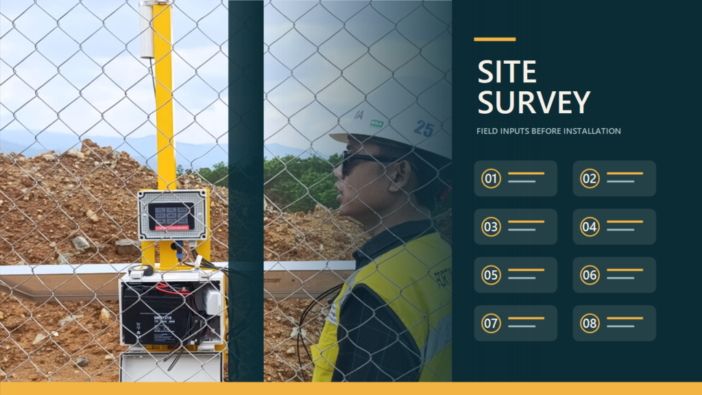
A monitoring site survey turns an operational need into installation decisions before equipment is mobilized. Its output is not merely a folder of photographs. It should explain what will be measured, where equipment can be mounted, how the station will obtain power and connectivity, and what the installation team must prove during commissioning.
A useful survey also prevents critical questions from appearing too late. A sensor bracket may lack a supporting structure, a solar panel may sit in seasonal shade, cellular signal may change between ground level and the planned antenna position, or the selected point may not represent the condition users actually need to observe. Resolving these findings during design is easier than improvising after a crew and equipment have reached the site.
Fortuna Argatech uses field inputs to configure sensors, data loggers, communication, monitoring platforms, and notifications. For example, the published GEOVOS Datalogger 1000 includes an RS485 sensor interface, 4G connectivity, 8 GB of local storage, a monitoring platform, and WhatsApp or email notifications. Those capabilities still require real information about sensor interfaces, network conditions, power, and the people expected to act on the data.
Start the monitoring site survey with an operational decision
Do not begin with a device list. Begin with the decision users must make: recognize rising water, identify a pump fault, observe changing weather, monitor water quality, or respond when a threshold is crossed. Record the parameter, unit, expected range, data interval, acceptable delay, dashboard users, and the action that follows a notification.
That objective determines whether the measurement point is representative. A well-installed sensor can still produce unhelpful data when it is too close to an inlet, heat source, structural shadow, vibration, sediment deposit, or another local condition that does not represent the monitored area. For water-level stations, the USGS guide Stage Measurement at Gaging Stations discusses site selection, damage exposure, access to reference gages, and the ability to maintain a datum. This article uses those points as hydrological context, not as a mandatory standard for every monitoring application.
Where a measurement depends on elevation or a fixed position, define a stable reference point and a method for checking it again. In other applications, the equivalent may be a sampling location, sensor direction, mounting height, orientation, or comparison reference. Put that information on a drawing instead of leaving it in one person’s memory.
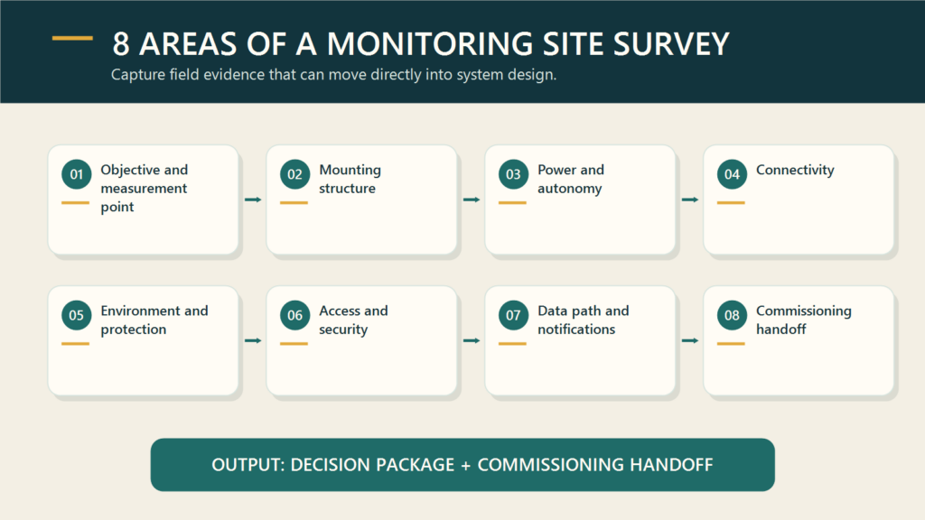
Eight areas the field record must cover
| Survey area | Question to answer | Minimum output |
|---|---|---|
| Objective and point | Does the point represent the condition users need to know? | Coordinates, parameter, range, photographs, and selection rationale |
| Mounting structure | Where can the sensor, panel, antenna, and cables be installed? | Sketch, dimensions, materials, cable route, and civil-work needs |
| Power | What sources are available and how long must the system operate? | Load inventory, primary source, backup, solar location, and autonomy assumptions |
| Connectivity | What network is available at the actual installation position? | Test results, alternative operator or medium, antenna position, and outage plan |
| Environment | What exposure exists to water, dust, heat, corrosion, vibration, lightning, or flooding? | Enclosure, protection, grounding, drainage, and material requirements |
| Access and security | Who can approach and service the equipment safely? | Route, permits, access equipment, locks, and work restrictions |
| Data path | How does data move from the sensor to the user? | Interface diagram, protocol, interval, storage, dashboard, and notification recipients |
| Handoff | What must be demonstrated after installation? | Acceptance criteria, reference check, test list, and accountable owners |
This table works as a compact field interview guide, but each answer should be backed by labeled photographs, measurements, coordinates, and traceable assumptions. Statements such as “good signal” or “sufficient power” are not yet design inputs.
Review structure, exposure, and maintenance access
Create a sketch that locates the sensor, bracket, enclosure, solar panel, antenna, cable routes, connectors, and supporting structure. Measure distances and elevations that affect cable length, voltage drop, communication paths, and inspection access. Record whether installation requires drilling, welding, a foundation, a mast, mechanical guards, or coordination with a structure owner.
Then consider a credible worst condition, not only the weather seen during the visit. Water can rise, vegetation can grow, vehicles can pass, sediment can move, and seasonal shade can cover a solar panel. At exposed sites, include lightning and surge exposure as protection-design inputs. At process sites, review heat, corrosive materials, vibration, dust, possible inundation, and local work-area rules. Enclosure ratings and grounding methods should follow the environment and site requirements rather than habit.
Maintenance access matters as much as installation access. A technician should be able to open the panel, clean or inspect the sensor, read a comparison instrument, remove a battery, and check connectors without creating an unsafe working position. Record entry permits, ladder or platform needs, access windows, lock points, and exposure to vandalism or theft.
Measure power and connectivity at the planned position
For power, list every load: sensors, data logger, modem, display, heater or fan when applicable, and auxiliary devices. Record normal operation and the highest credible consumption state, then define the primary source, backup, autonomy target, and recharge method. For solar power, document direction, tilt, shade across the day, mounting space, contamination exposure, and cleaning access. USGS guidance describes batteries, converted AC power, chargers, and solar panels for hydrological stations, but a project calculation must use the actual equipment load and local conditions.
For connectivity, test at the planned antenna height and position. Record the time, network technology, operator, stability, and results from different orientations where relevant. A phone showing signal at ground level does not prove that a modem inside the final enclosure will perform as required. If the primary network is unavailable, document whether the design needs an external antenna, another operator, radio, satellite, local collection, or scheduled site visits.
The 8 GB local storage published for GEOVOS can support a data-continuity strategy, but retention time depends on the number of parameters, file format, and logging interval. The survey therefore needs to state how long the station should operate without communication and how stored records will be synchronized after connectivity returns.
Draw the data path before choosing the final configuration
A monitoring site survey should map the complete route: sensor, interface, data logger or gateway, network, server or cloud, dashboard, notification, and responsible person. At each connection, identify the protocol, cable or communication medium, power source, owner, and failure condition that needs to be visible.
In an Automatic Water Level Recorder, for example, sensor technology can be adapted to field conditions and data can be delivered to web or cloud monitoring. If the project measures water level, the guide to choosing water level sensors becomes useful after the survey documents mounting position, level range, surface conditions, sediment, and maintenance needs.
Do not stop at the dashboard. Define who receives a notification, what condition triggers it, which channel is used, and what response is expected. Also verify time zone, engineering units, station naming, user permissions, retention, export, and integration with other systems. This is where field, IT, operations, and management teams can uncover conflicting assumptions before configuration begins.
Finish with a decision package and commissioning handoff
The survey report should produce four outputs. First, a site and architecture drawing showing locations and connections. Second, an assumption and open-risk register with an owner for each follow-up. Third, a preliminary bill of materials that marks items awaiting confirmation. Fourth, installation and commissioning acceptance criteria.
Acceptance criteria may cover sensor position, structural integrity, polarity and voltage, reading against a reference, platform connectivity, local storage, notification receipt, cable labels, photographic documentation, and user training. Their values must be specific to the project. With this handoff, the commissioning team does not have to infer design intent, and the project team can distinguish a field change from an installation defect.
Fortuna Argatech can help evaluate measurement-point requirements and develop a monitoring configuration from the sensor to the dashboard. For an initial technical discussion, prepare the measurement objective, site coordinates and photographs, available power, network conditions, supporting structures, environmental risks, notification needs, and systems that require integration. Better field inputs make the engineering discussion faster and the recommendation easier to defend.
Technical references
- Fortuna Argatech, GEOVOS Datalogger 1000 and Automatic Water Level Recorder pages, accessed July 23, 2026.
- U.S. Geological Survey, Stage Measurement at Gaging Stations, Techniques and Methods 3-A7, 2010.
Share this article
Share this insight with your team.
Related Articles
Similar topics from the same category.
Poor weather station placement can cause 50% data bias. Learn the WMO-No. 8 and Indonesian BMKG siting standards for AWS sensors in industrial and mining sites.
Explore a technical engineering comparison between solid-state ultrasonic anemometers and mechanical cup-and-vane sensors for industrial weather stations.

Technical guide to conductivity sensors: comparing toroidal (inductive), 2-electrode, and 4-electrode contacting probes for industrial water and wastewater.