Project
Overview
About This Project
Background
Extensometer SAE shows a need for more structured landslide monitoring in the Baturraden geothermal work area in Central Java. The package is not a single device only. The document shows a full setup that combines ground movement detection, weather monitoring, communication, and warning devices.
In this context, Extensometer is relevant for reading ground movement, while Weather Station helps record rainfall, wind speed, and wind direction. For a broader early-warning overview, see EWS Longsor: Cara Kerja, Komponen, dan Manfaatnya.
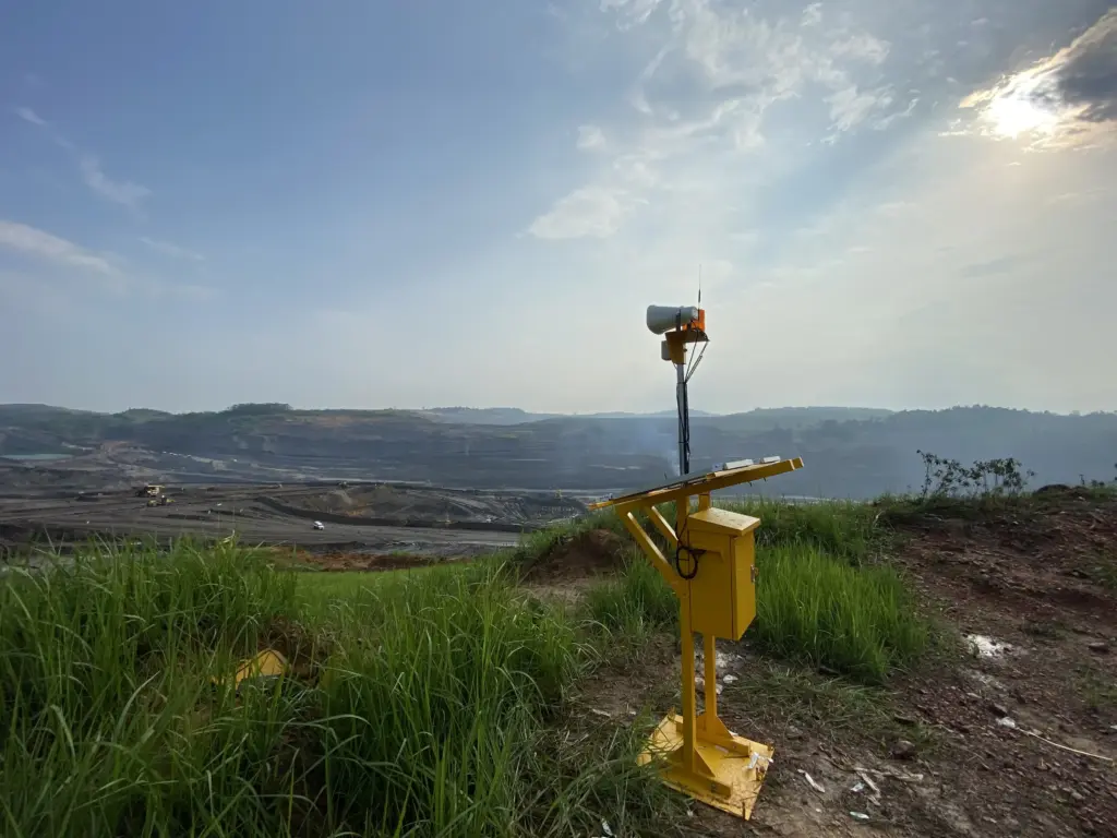
Extensometer SAE in Baturraden
This package is best understood as one landslide warning system. The main purpose is to support slope observation and give the field team a faster basis for inspection.
Implementation Goal
The goal of the Extensometer SAE implementation is to help the field team read slope changes faster and in a more organized way. With extensometer, weather station, data logger, and communication devices working together, the monitoring process becomes more structured.
The setup also supports readiness. If there are changes in the ground or weather conditions that need attention, the team has early data to decide whether a follow-up inspection is needed.
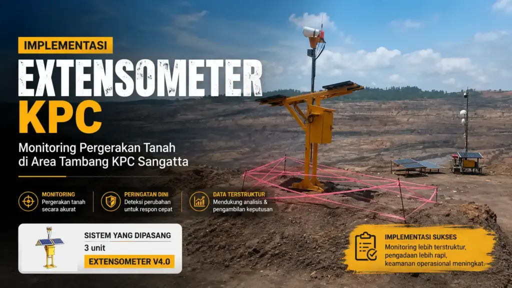
Installed System
Based on the screenshots, the final package includes:
- 3 Wireless Extensometer Sensors
- 1 Warning System
- 1 Repeater
- 1 Data Logger / Receiver & Online System
- 1 Weather Station for rainfall, wind speed, and wind direction
- 1 Alarm Radio Channel (HT)
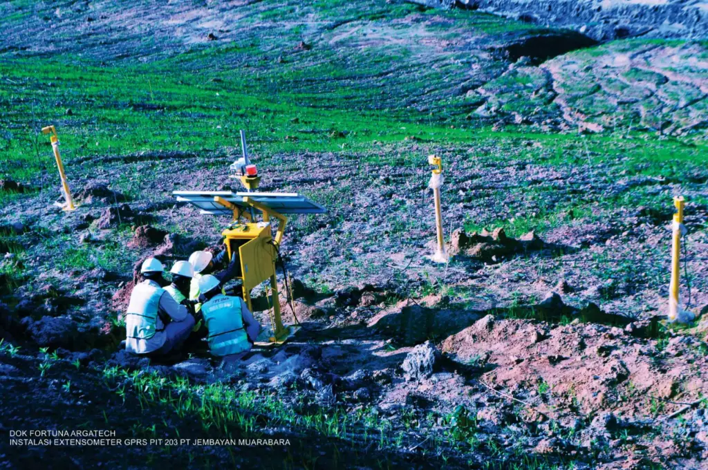
- Installation
- Fence for Main Unit
Implementation Process
- The team received the landslide monitoring need from PT Sejahtera Alam Energy.
- The package specification was shaped through price negotiation and the online system module configuration.
- The main devices, weather station, and communication tools were prepared according to the item list.
- Installation, SOP training, and delivery followed the terms in the attachment.
- Monitoring data was then used as a basis for slope checks and field follow-up.
Results
The Extensometer SAE implementation helps create a more organized monitoring flow for a landslide-prone area. By combining ground movement readings with weather data, the team gets a clearer basis for inspection and follow-up.
Another visible benefit is the support from the online system, the free Telemetry GSM data package, and SOP training. These three points help the system work not only as installed equipment, but also as an operational tool.
Closing
If you need a landslide monitoring package, extensometer, weather station, or landslide warning system for geothermal sites, mining areas, or slope-prone locations, Fortuna Argatech can tailor the device configuration to your site needs.
FAQ
What is the role of Extensometer SAE in this project?
Extensometer SAE is used to help read ground movement and support landslide monitoring.
Why is a weather station included?
Because rainfall, wind speed, and wind direction help explain site conditions that can affect landslide risk.
Does this package use online monitoring?
Yes. Data Logger / Receiver & Online System and also Telemetry GSM in the attachment.
Is operator training included?
Yes. 2 days of SOP training for monitoring, maintenance, and troubleshooting.
Sources
- Fortuna Argatech. (21 April 2026). EXTENSOMETER. https://argatech.com/produk/extensometer/
- Fortuna Argatech. (21 April 2026). Weather Station. https://argatech.com/produk/weather-station/
- Fortuna Argatech. (21 April 2026). EWS Longsor: Cara Kerja, Komponen, dan Manfaatnya. https://argatech.com/ews-longsor-cara-kerja-komponen-dan-manfaatnya/
Applied Solutions
Products and solutions used in this project implementation.
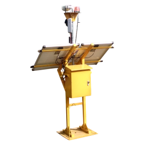
EXTENSOMETER
Extensometer – real-time slope stability monitoring & landslide early warning system with precise surface deformation detection.
View Details